Data
Our goal is a coherent, integrated Arctic observing system using the SAON (Sustaining Arctic Observation Networks) Data Portal. This approach considers and integrates already existing similar activities and develops tools and services to simplify FAIR (Findable, Accessible, Interoperable, Reusable) data generation and publication of analysis-ready datasets.
New datasets and online data portals and tools
In addition to the SAON Data Portal, several other online services and datasets are being developed under Arctic PASSION: A total of 150 Arctic PASSION-related datasets, ranging from atmospheric to ice and oceanographic measurements, have been curated and archived as of December 2nd 2025.
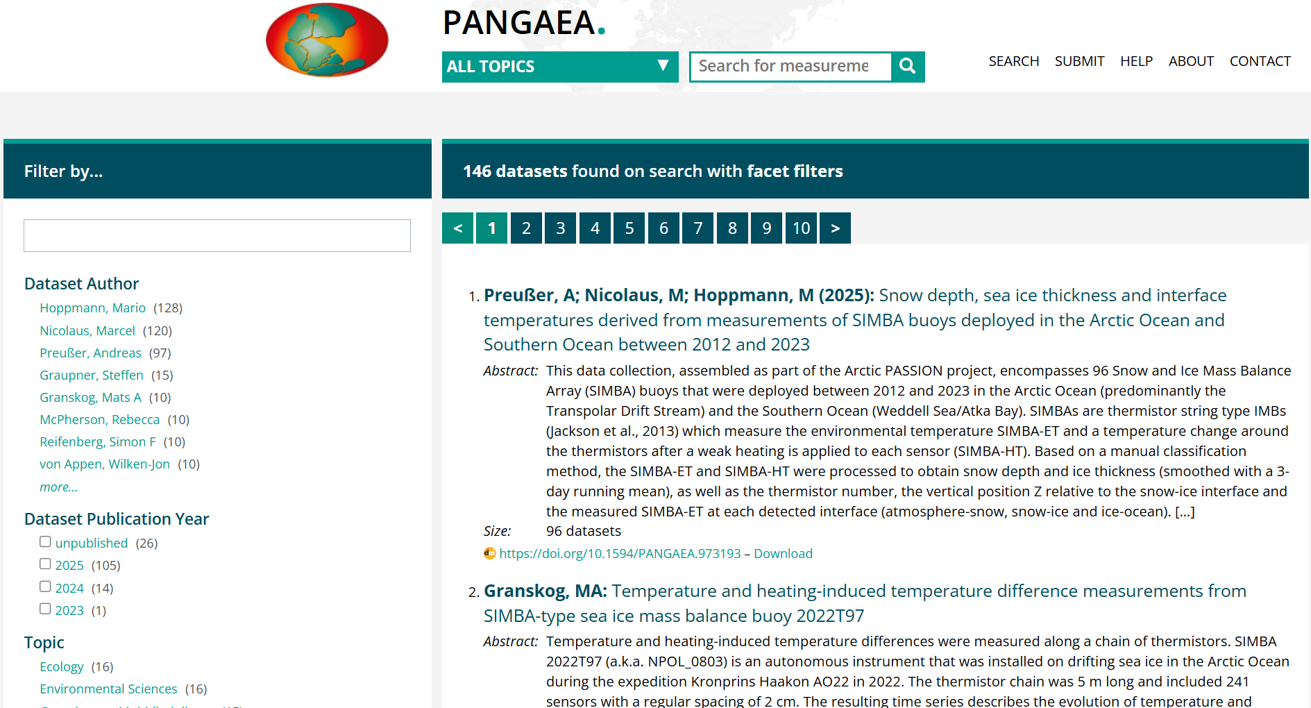
PANGAEA
PANGAEA is an Open Access library aimed at archiving, publishing and distributing georeferenced data from earth system research. PANGAEA guarantees long-term availability (greater than 10 years) of its content. PANGAEA is open to any project, institution, or individual scientist to use or to archive and publish data. PANGAEA focuses on georeferenced observational and experimental data. Citability, comprehensive metadata descriptions, interoperability of data and metadata, a high degree of structural and semantic harmonization of the data inventory as well as the commitment of the hosting institutions to ensure FAIRness of archived data. PANGAEA contains 119 records of Arctic PASSION data as of December 2nd 2025.
Zenodo
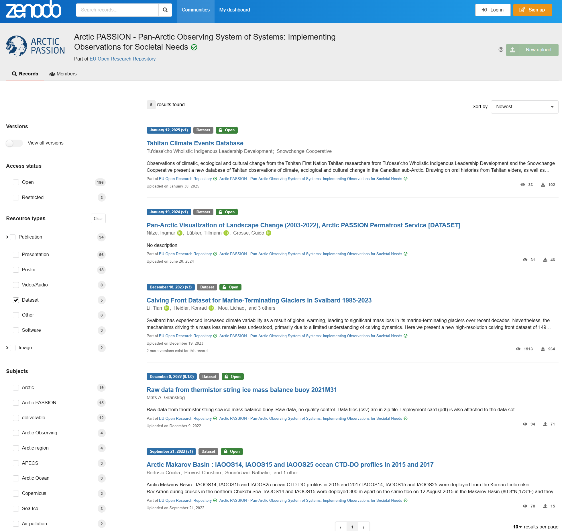
The repository for European Commission-funded research contains four Arctic PASSION datasets as of December 2nd 2025.
- Calving Front Dataset for Marine-Terminating Glaciers in Svalbard 1985-2023
- Tu'dese'cho Wholistic Indigenous Leadership Development, & Snowchange Cooperative. (2025). Tahltan Climate Events Database
- Arctic Makarov Basin: IAOOS14, IAOOS15 and IAOOS25 ocean CTD-DO profiles in 2015 and 2017
- Raw data from thermistor string ice mass balance buoy 2021M31 (0.1.0)
The Norwegian Polar Institute
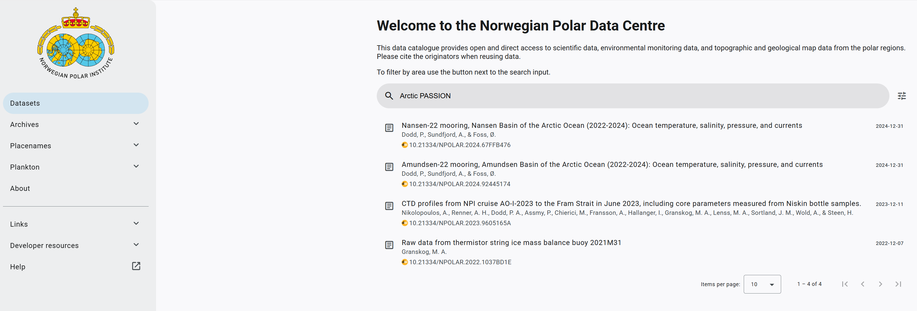
The Norwegian Polar Data Centre catalogue provides open and direct access to scientific data, environmental monitoring data, and topographic and geological map data from the polar regions, and contains three Arctic PASSION datasets as of December 2nd 2025.
- Amundsen Basin of the Arctic Ocean (2022-2024): Ocean temperature, salinity, pressure, and currents
- Nansen Basin of the Arctic Ocean (2022-2024): Ocean temperature, salinity, pressure, and currents
- CTD profiles from NPI cruise AO-I-2023 to the Fram Strait in June 2023, including core parameters measured from Niskin bottle samples
The Norwegian Meteorological Institute
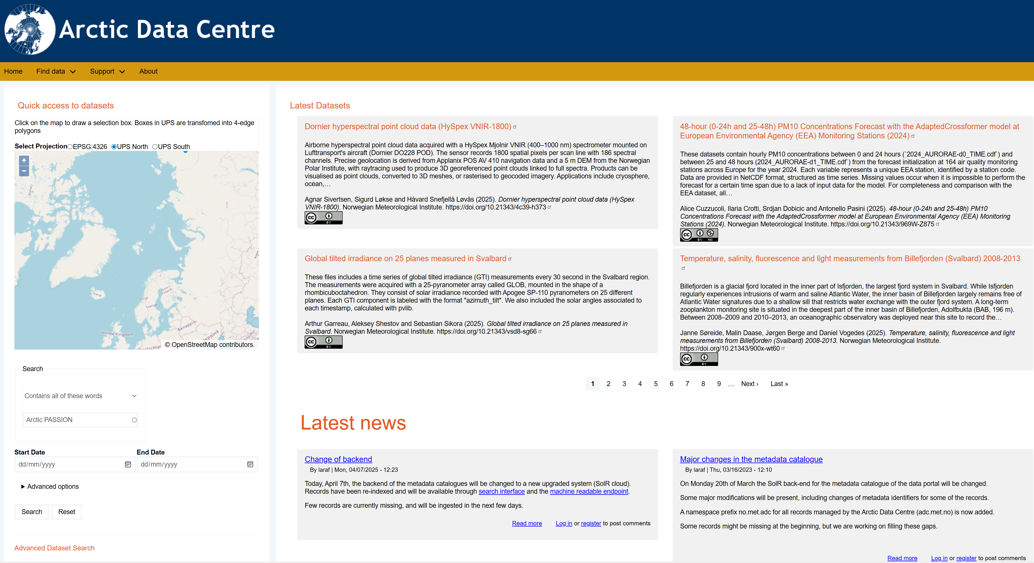
The Arctic Data Centre (ADC) is a service provided by the Norwegian Meteorological Institute (MET) and is a legacy of the International Polar Year (IPY) when MET coordinated operational data streams internationally and research data nationally. ADC is focused on the FAIR principles for data management, and contains two Arctic PASSION datasets as of December 2nd 2025.
- Data from drifting, autonomous ice-tethered observatories deployed in June 2022 at 89.82N, 26.28W
- 48-hour (0-24h and 25-48h) PM10 Concentrations Forecast with the AdaptedCrossformer model at European Environmental Agency (EEA) Monitoring Stations (2024)
The Italian Arctic Data Center
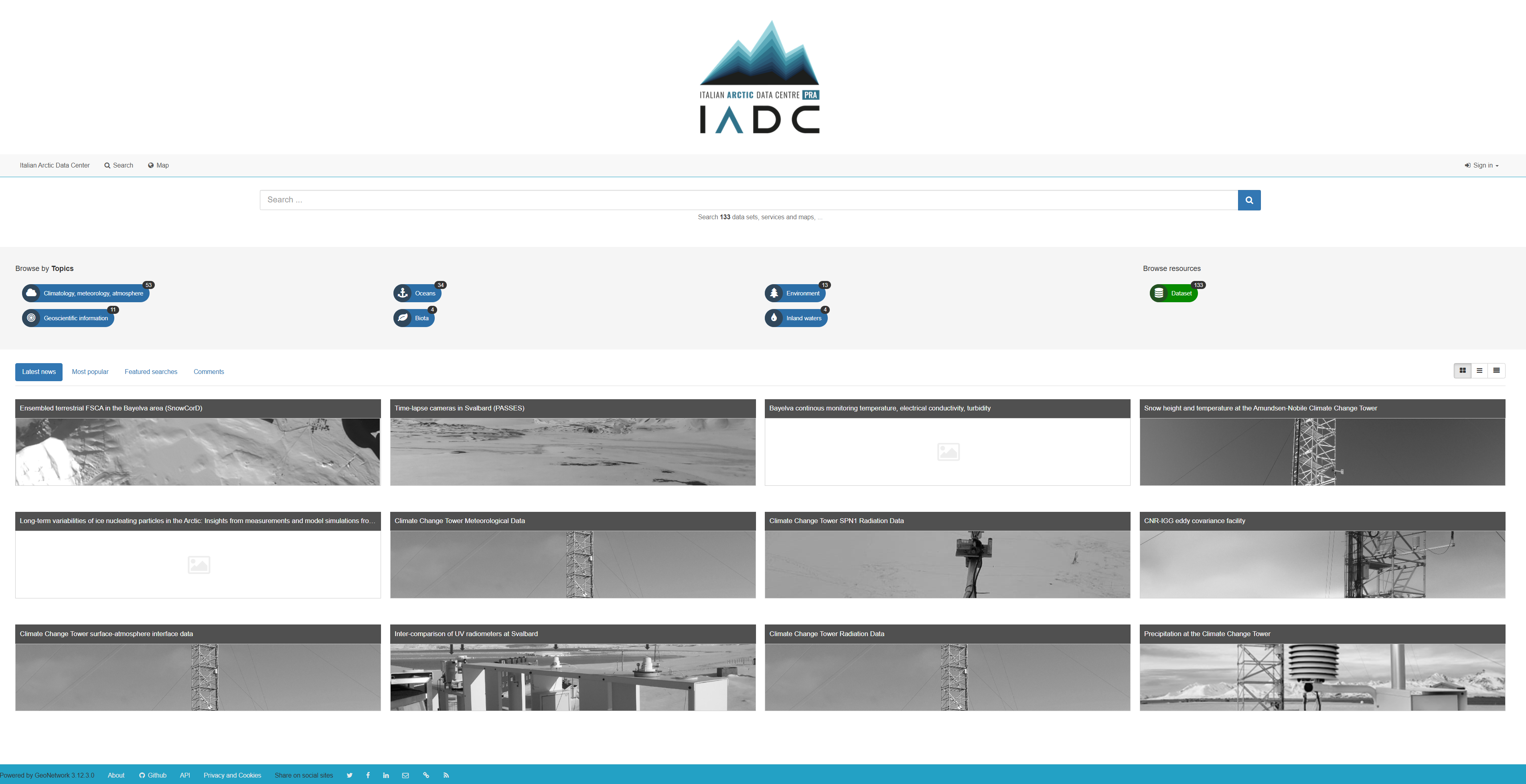
Powered by GeoNetwork, a catalog application to share information for search and discovery, the Center contains one Arctic PASSION dataset as of December 2nd 2025: Climate Change Tower Radiation Data.
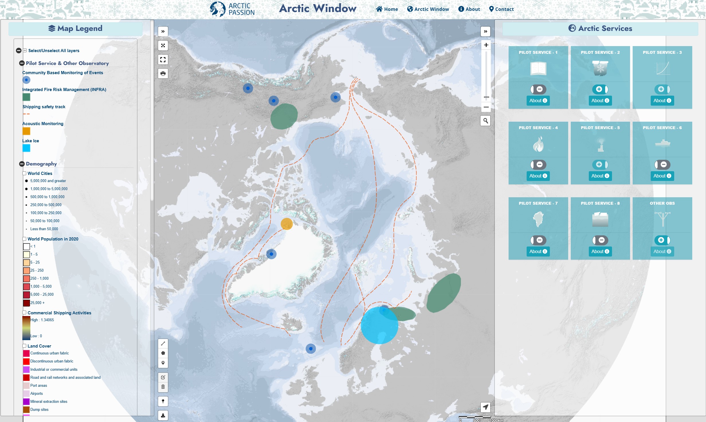
Arctic Window provides a gateway to the new Arctic services developed and observations carried out by the project. It will be further developed over the entire project. You can access the Arctic Window via the top menu or using this link.
The Sea Ice Portal
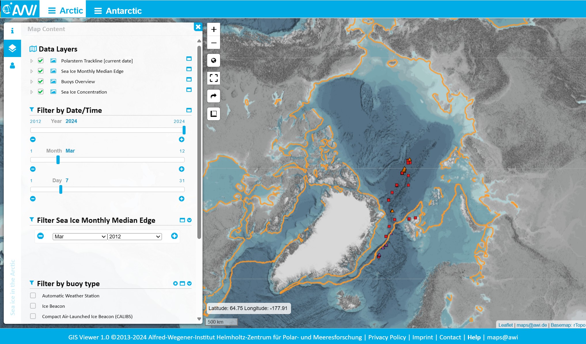
The sea ice portal gives up-to date data information about polar sea ice, including near real-time data from buoys deployed in the Arctic Ocean. Arctic PASSION contributes with the gathering of scientific data and have deployed buoy measuring air, snow, ice and water temperatures, atmospheric pressure, snow depth and solar radiation as well as its GPS position. You can access the Sea Ice Portal here.
Arctic Seas Portal
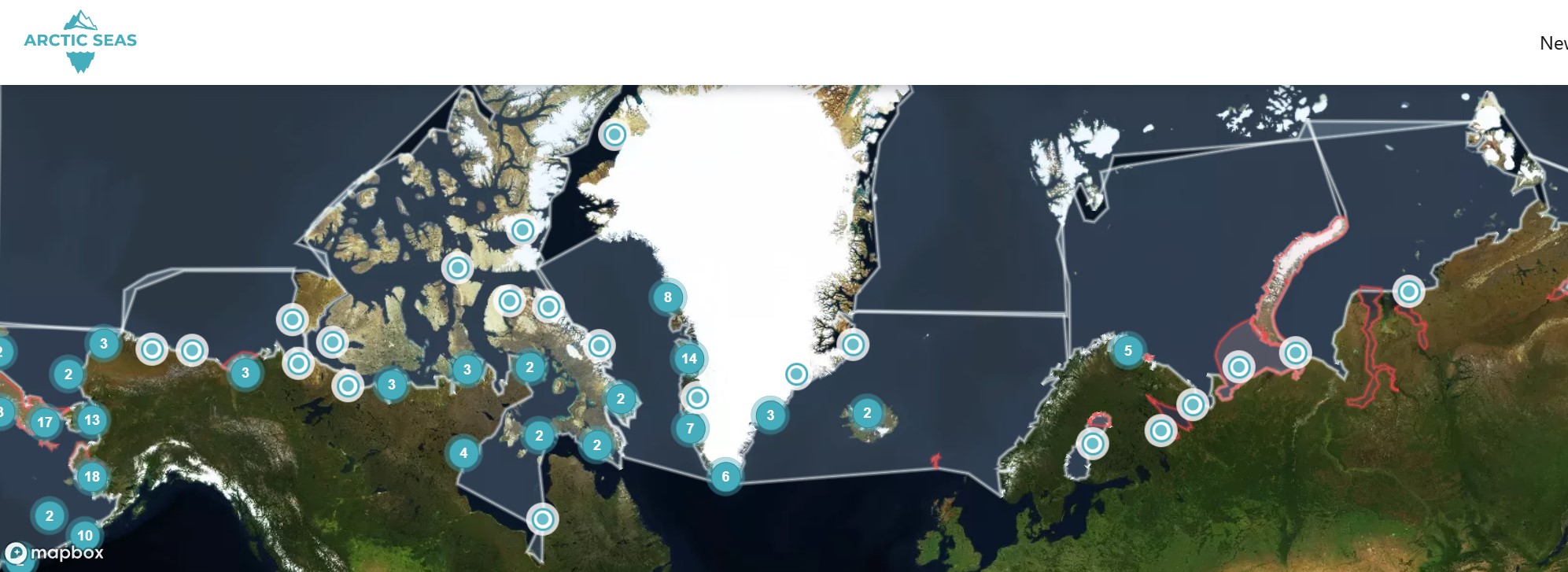
Arctic PASSION is supporting Arctic Seas Portal by non-profit Snowchange Cooperative, a network of local and Indigenous communities around the north. You can access the Arctic Seas Portal through this link.
Arctic Landscape Explorer tool (ALEX)
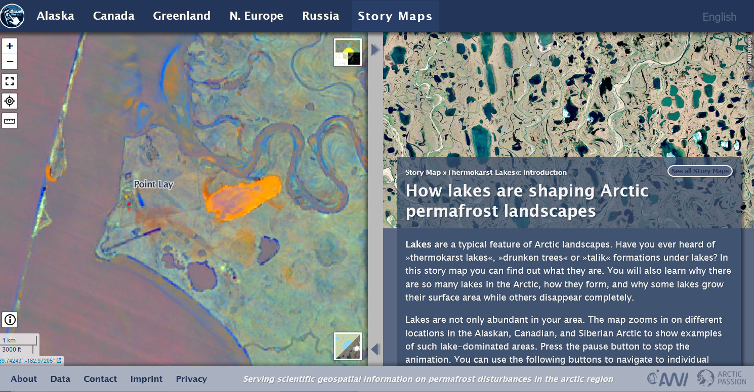
Arctic PASSION is enhancing a permafrost online tool by customising it to the non-scientific end-users needs as one of its services. The tool has been shown to people who are living and taking decisions in the Arctic and for their input on how it can be optimised for their needs and what they are particularly interested in. You can access ALEX via this link or read more about the Pan-Arctic requirements-driven Permafrost Service on our website.
Lake Ice Service for Arctic Climate and Safety
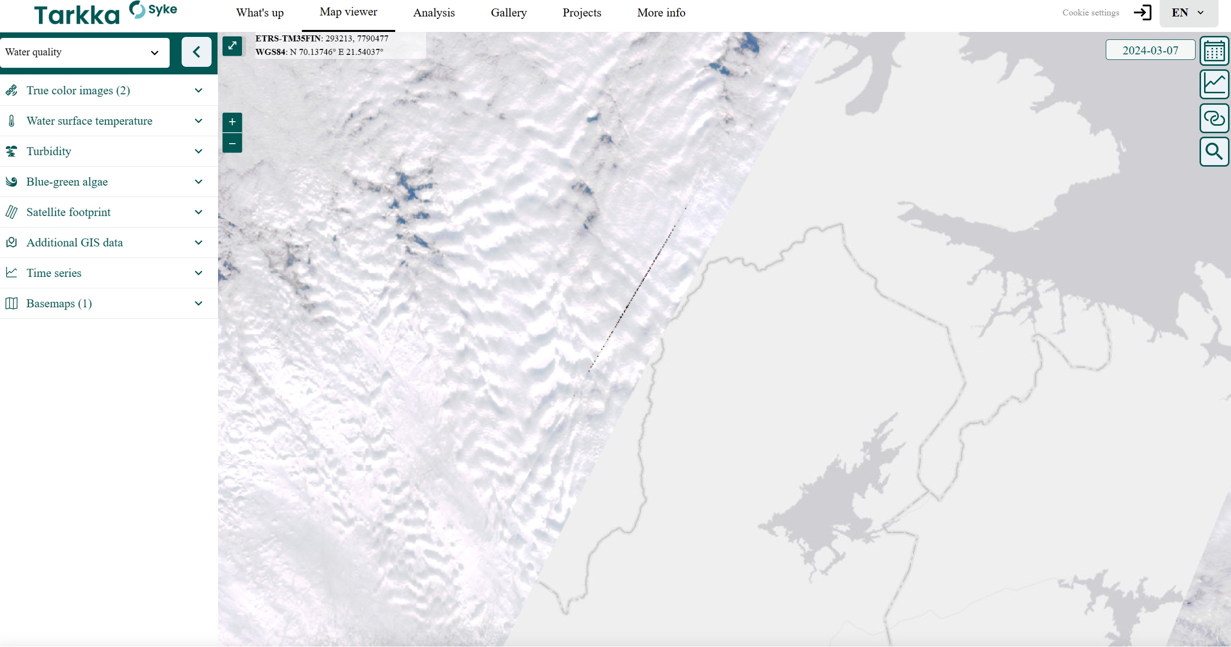
The Finnish Environment Institute’s Earth Observation service for Arctic climate and safety includes a lake ice service, providing near real-time information about the ice conditions of freshwater lakes, based on satellite imagery and in-situ information (community-based monitoring and governmental observations). It’s an excellent tool for visualizing spatiotemporal data in map format or as statistical time series. You can access the Lake Ice Service here or read more about the Lake Ice Service for Arctic Climate and Safety.
the Italian Arctic Data Center: https://metadata.iadc.cnr.it/
Zenodo: https://zenodo.org/
Daily Sea Ice Index
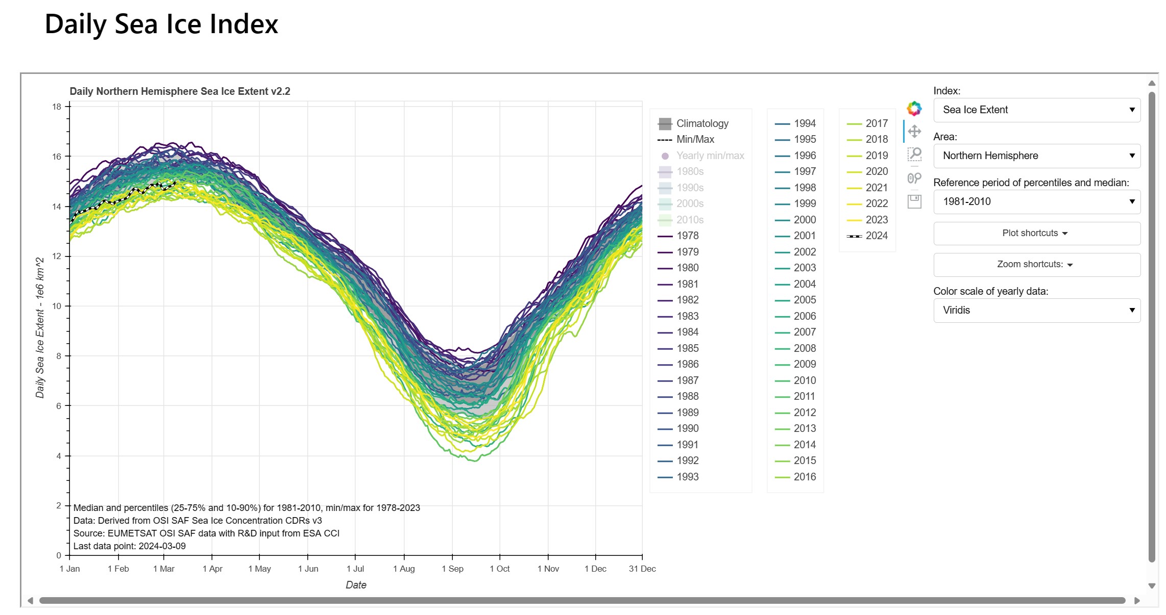
The Norwegian Meteorological Institute has developed a tool for sea ice extent visualization. Sea Ice Extent is defined as the area covered by a significant amount of sea ice and is one of the headline indicators for climate change. The Sea-ice concentration data is taken from the EUMETSAT OSI SAF. The tool can visualize both daily and monthly sea-ice extent, at global and regional scales.
An Integrated Fire Risk Management (INFRA) Service for Arctic wildfires
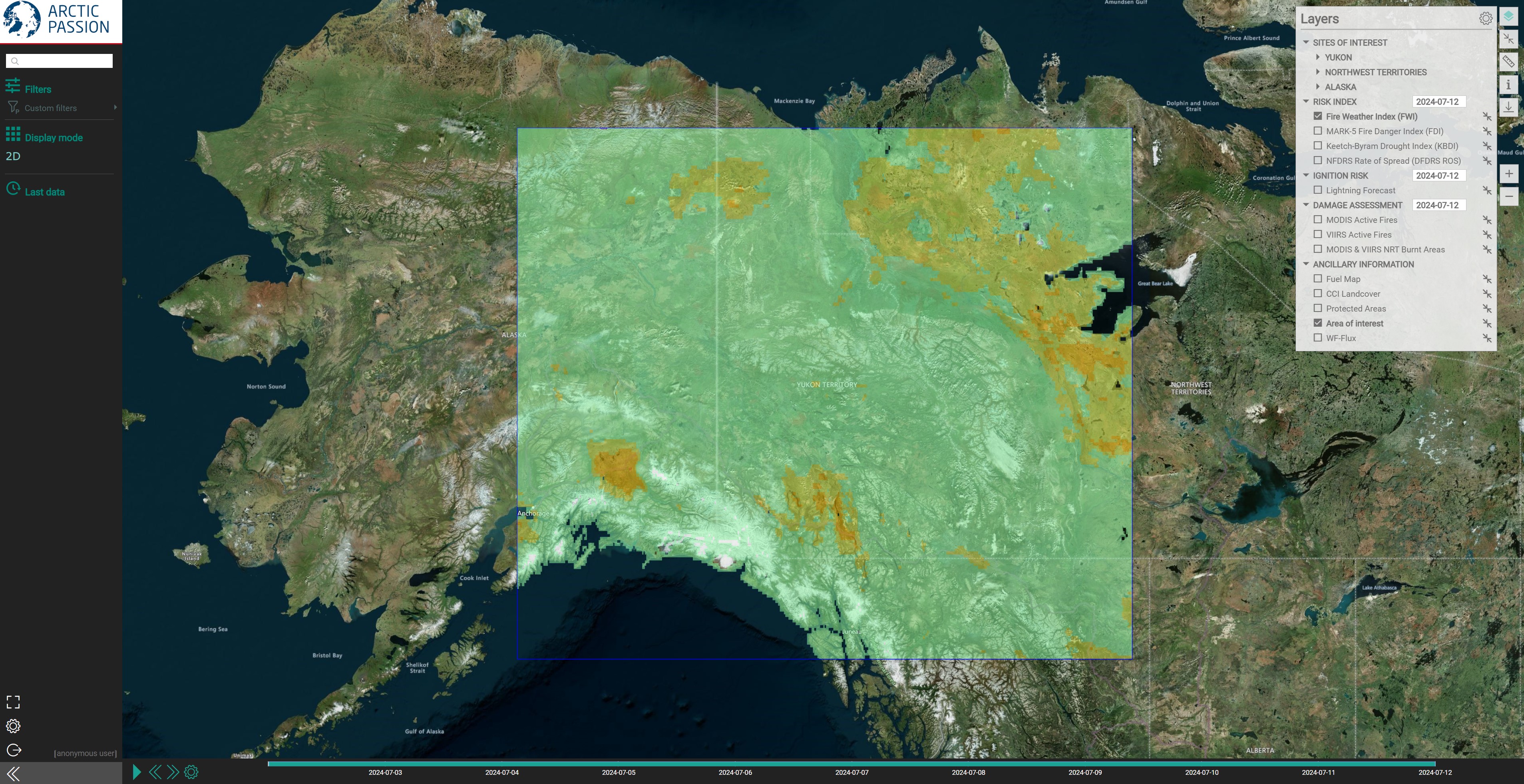
Arctic PASSION is developing a web mapping service for wildfires to make the access to relevant information and products easier from diverse sources. Focusing on a local scale, INFRA provides the possibility to generate and distribute messages on wildfires that are tailored to non-scientific end-users like municipalities, as well as Indigenous Peoples and local communities. The service currently covers the following areas:
You can read more about INFRA on our website.
The Air Quality Forecast for Arctic Communities (AURORAE) service
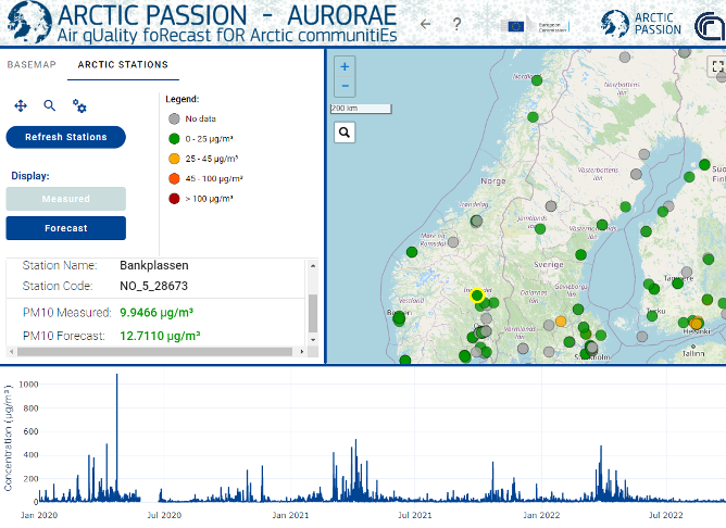
Arctic PASSION is developing an air pollution forecast website designed for non-scientific users living and working in North European countries and in the European Arctic. The AUROARAE service aims at empowering Nordic and Arctic communities on relevant topics such air quality and its effects on public health, and to promptly take action in case of episodes of high level of air pollution. You can have a look at the preliminary version of the website via this link.
New high-resolution calving front dataset of Svalbard
The University of Bristol has produced a new high-resolution calving front dataset of 149 marine-terminating glaciers in Svalbard using deep learning methods. This dataset comprises 124919 glacier calving front positions from 1985 to 2023. You can access the data via the Arctic PASSION community on Zenodo and read more about the Svalbard calving front mapping methods in the article published in Earth System Science Data (ESSD) in 2024.
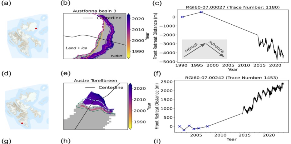
Figure. Examples of glacier calving front change time series of two different glaciers located across Svalbard.
New pan-Arctic land-ice and tundra meltwater discharge database from 1950 to 2021
The University of Bristol has produced a pan-Arctic land-ice and tundra meltwater discharge database from 1950 to 2021 using the daily regional climate model Modéle Atmosphérique Régional (MAR). You can access the data via the information system PANGAEA and read more about the pan-Arctic meltwater discharge from the Earth System Science Data (ESSD).
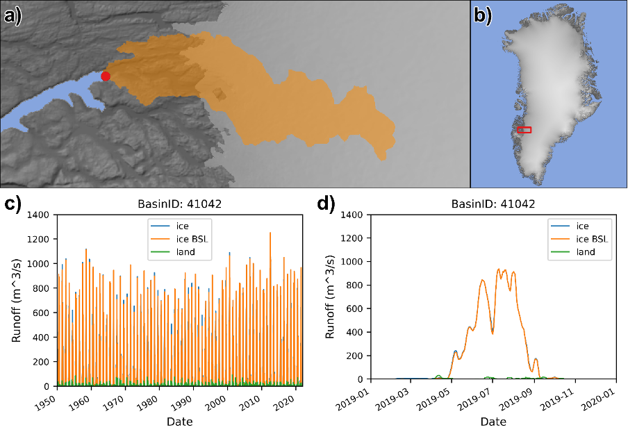
Figure. An example of the basin-specific daily runoff data. (a) Coverage of the drainage basin, which includes Leverett and Russel Glaciers in West Greenland, and its coastal outflow point, (b) overview map. (c) Seven-day running average of the coastal meltwater discharge from ice, land and bare ice – i.e. ice below snow line (BSL) – runoff between 1950 and 2021, (d) zoomed in view of the same graph between 2019 and 2020.
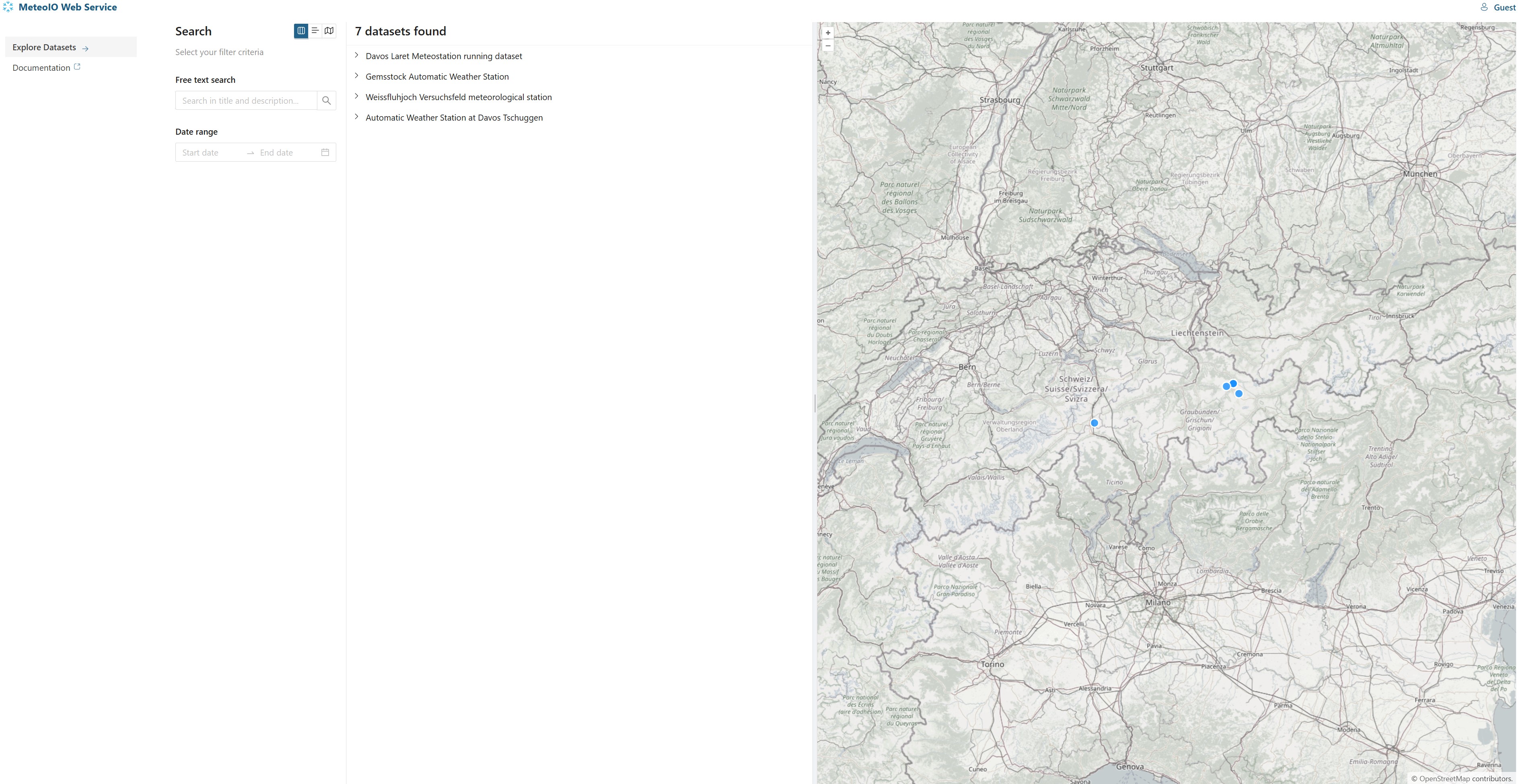
MeteoIO