New Arctic Passion Datasets For Improved Arctic Shipping And Research Activities.
by Gorm Dybkjær and Arild Sundfjord | Published: 25-Apr-25 | Last updated: 20-Feb-25 | Tags : Arctic | category: NEWS
The Arctic is transforming rapidly, yet gathering reliable data observations remains a challenge and data observations in the Arctic are sparse. As a part of Arctic PASSION’s mission to establish an adaptive and more complete arctic observing system, our project partners have released new datasets that can help improve shipping and research activities in the Arctic. These datasets provides vital insight into the regions ongoing changes.
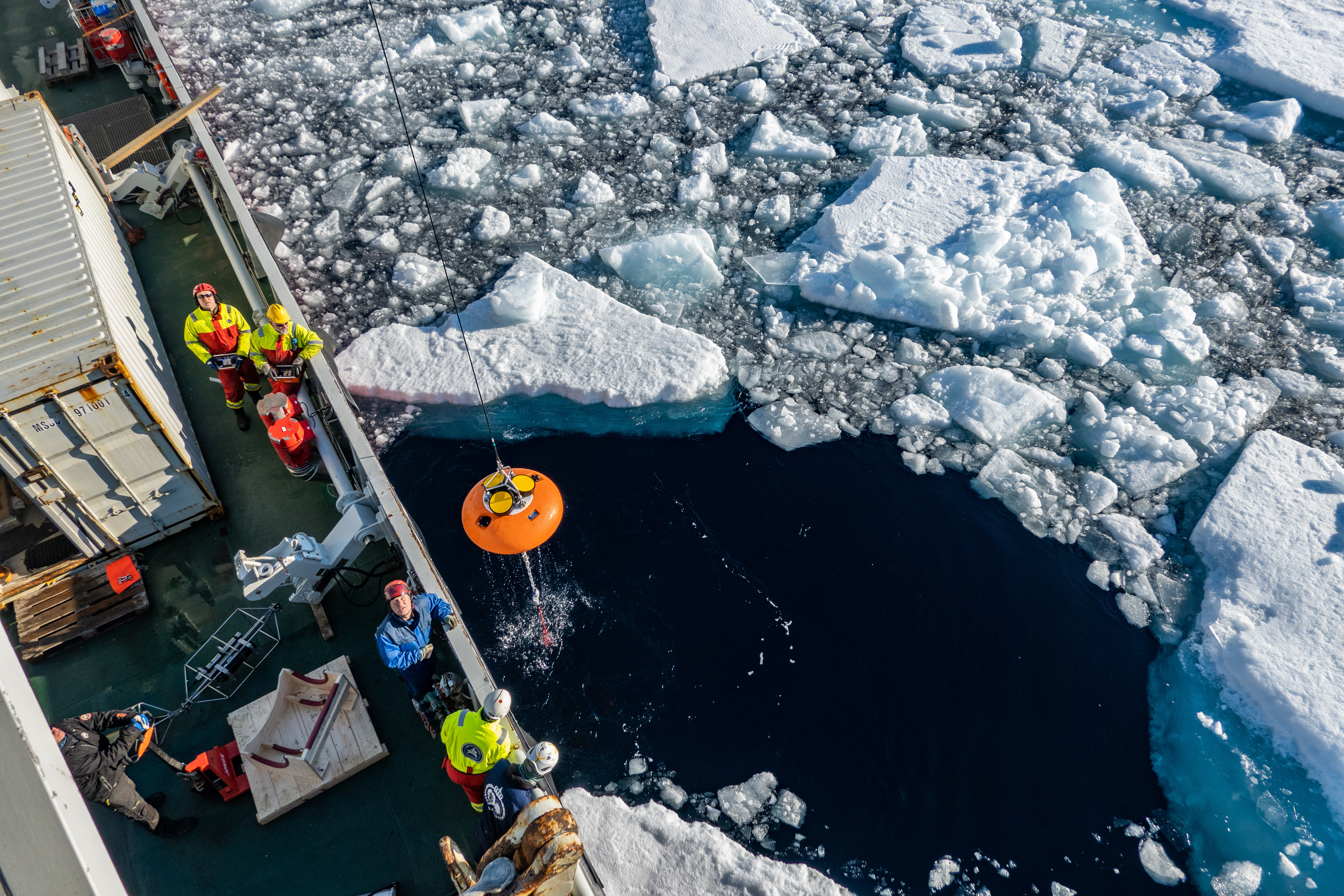
Photo: Trine Lise Sviggum Helgerud, Norwegian Polar Institute
In an effort to build a comprehensive Arctic observing system of systems that builds on, coordinates and enhances existing observing infrastructures and networks, Arctic PASSION has prioritized expanding long-term observations at new strategic locations in the Eurasian parts of the central Arctic Ocean, using sensors on drifting sea-ice platforms (“buoys”) and fixed-position (bottom-anchored) deep-ocean moorings. Together, the instruments on the drifting buoys and moorings measure the sea ice and its snow cover, and the deep water column below it, filling crucial knowledge gaps.
FRM surface temperature datasets
Fiducial Reference Measurements (FRMs) refer to high-quality, long-term, and well-documented measurements that serve as benchmarks for validating satellite data and other observational methods. FRMs are crucial for ensuring the accuracy, precision and reliability of remote sensing data in the Arctic, where environmental monitoring is particularly challenging due to harsh conditions and limited accessibility.
Arctic PASSION datasets include:
- A 10-year sea ice temperature dataset for Northwest Greenland
- A global dataset of the mean sea ice surface temperature with data for a 43-year period
- A 10-year Risk Index Outcome (RIO) dataset that can act as climatological reference for operational data for ships navigating in ice-infested waters, and as a ship routing planning tool.
These perform end-to-end calibration of satellite products to contribute to an integrated Arctic observing system that integrates the satellite observation system with traditional ground-based observation and feed into other areas of the project, such as the service ‘Improving Safety for shipping in the Polar Seas’, and facilitate process studies, operational activities, reanalysis, prediction, management and climate models. The datasets are freely available on public data portals, including SAON's website.