Integrating Local Environmental Observations And Remote Sensing For Researching Permafrost Landscape Changes
by Prof. Dr. Guido Grosse | Published: 11-May-23 | Last updated: 04-May-23 | Tags : Alaska Arctic drainage Lake permafrost remote resear4ch sensing thaw | category: NEWS
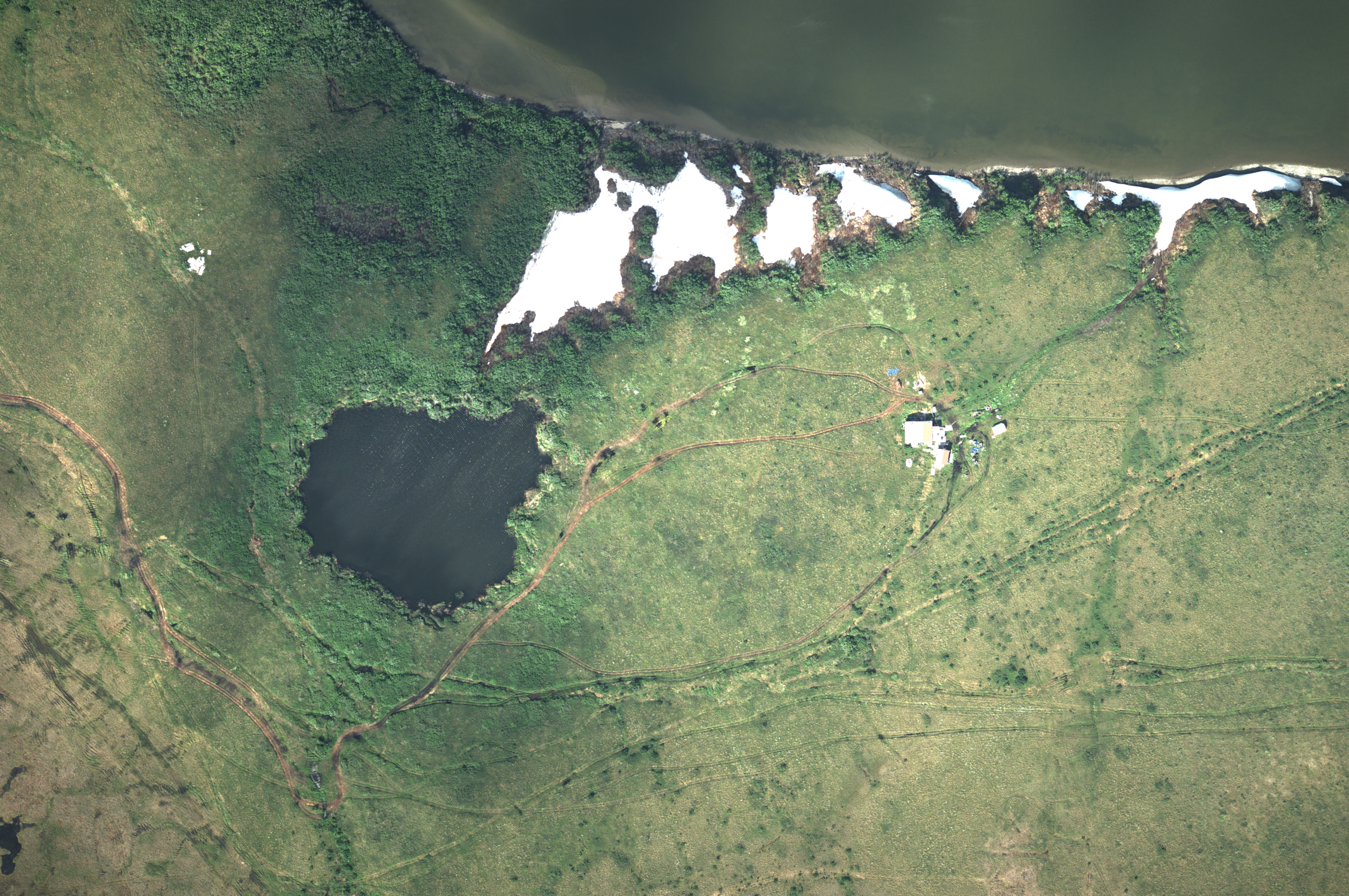
The formation and drainage of lakes in the Arctic represent dominant landscape change processes in permafrost regions. Better understanding these processes and documenting drainage events is of importance to climate change research, wildlife and habitat studies, access to subsistence resources, and the wellbeing of northern socioecological systems.
During an AWI Perma-X ground expedition in northwestern Alaska in the summer of 2021, a small thermokarst lake on a native allotment camp site drained catastrophically. After being informed about the event by the local environmental observer network, Ben Jones was able to use an unmanned aerial vehicle (UAV) to map the freshly drained lake basin and this was subsequently combined with remote sensing and the knowledge of local environmental observers to quantify and understand how and why the small lake drained.
Here is an image of the Scheffer Lake before it drained, in July 2021, taken from Perma-X 2021 flight campaign onboard Polar-6, using a DLR MACS camera (Modular Aerial Camera System) built by the German Aerospace Agency (DLR). Credit: AWI.
The AWI expedition resulted in an Arctic PASSION publication, a paper on catastrophic lake drainage for a small thermokarst lake on a native allotment near Kotzebue in the northwestern Alaska Arctic region together with local environmental observers. The article "Integrating local environmental observations and remote sensing to better understand the life cycle of a thermokarst lake in Arctic Alaska" was recently published in Arctic, Antarctic, and Alpine Research and is now available for download: https://www.tandfonline.com/doi/full/10.1080/15230430.2023.2195518.
The local envionmental observers are co-authors of this study, and AWI contributed Perma-X 2021 airborne campaign data from the year before drainage for the analysis.
Thumbnail image: Photos from the LEO post on the sudden lake drainage event that happened on June 29th 2022. (a) Oblique aerial photo of the drained lake basin on 10 August 2022 (photo credit: Sebastian Zavoico). (b) Ground photo of the recently exposed drained lake basin floor and (c) the thermo-erosional drainage gully that formed during the drainage event (photo credits: Susan Tessier, 29 June 2022). (d) The thermo-erosional drainage gully fifty-four days after the lake drained showing continued permafrost thaw and ground ice melt since the drainage event (photo credit: Benjamin Jones).