Preliminary Tool To Explore Changing Arctic Permafrost Regions
by Anna Irrgang | Published: 28-Nov-22 | Last updated: 28-Nov-22 | Tags : Arctic permafrost | category: NEWS
Introducing the first
preliminary tool to explore Arctic permafrost region disturbances and landcover changes at 30 m resolution developed within CCI Permafrost, Permafrost
Discovery Gateway, and Arctic PASSION. You can access the permafrost tool via this link.
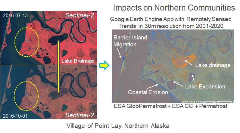
After entering the portal, you will see that the tool uses the time period between 2000 and 2019. On the right side, you can choose from a number of disturbances and regions affected. Choose one of them and then move the slider - you will see the changes appearing in different colours. We are currently working on a legend, which explains the different colours. Important for now is, that wherever you see flashing colours there is a substantial change of the landscape - along the coast for example it indicates either coastal erosion, or coastal accretion.
The tool has been shown to numerous people who are living and making decisions about the Arctic and for their input on how we can optimize it for their needs and what they are particularly interested in, enabling us to customize the tool to non-scientific users needs.
Update: The Arctic Landscape EXplorer (ALEX) has been released in early 2024. You can use the portal to explore an updated version of the change map.