Permafrost Field Work And Consultations On The Arctic Landscape Explorer (Alex) In Western Alaska
by Tillmann Lübker | Published: 19-Dec-23 | Last updated: 12-Dec-23 | Tags : Alaska Arctic Arctic Landscape Explorer Fieldwork permafrost | category: NEWS
Please enjoy this firsthand account of permafrost fieldwork in Alaska by Tillmann Lübker, a geospatial data scientist at the Alfred Wegener Institute Helmholtz Centre for Polar and Marine Research's Department of Permafrost Research.
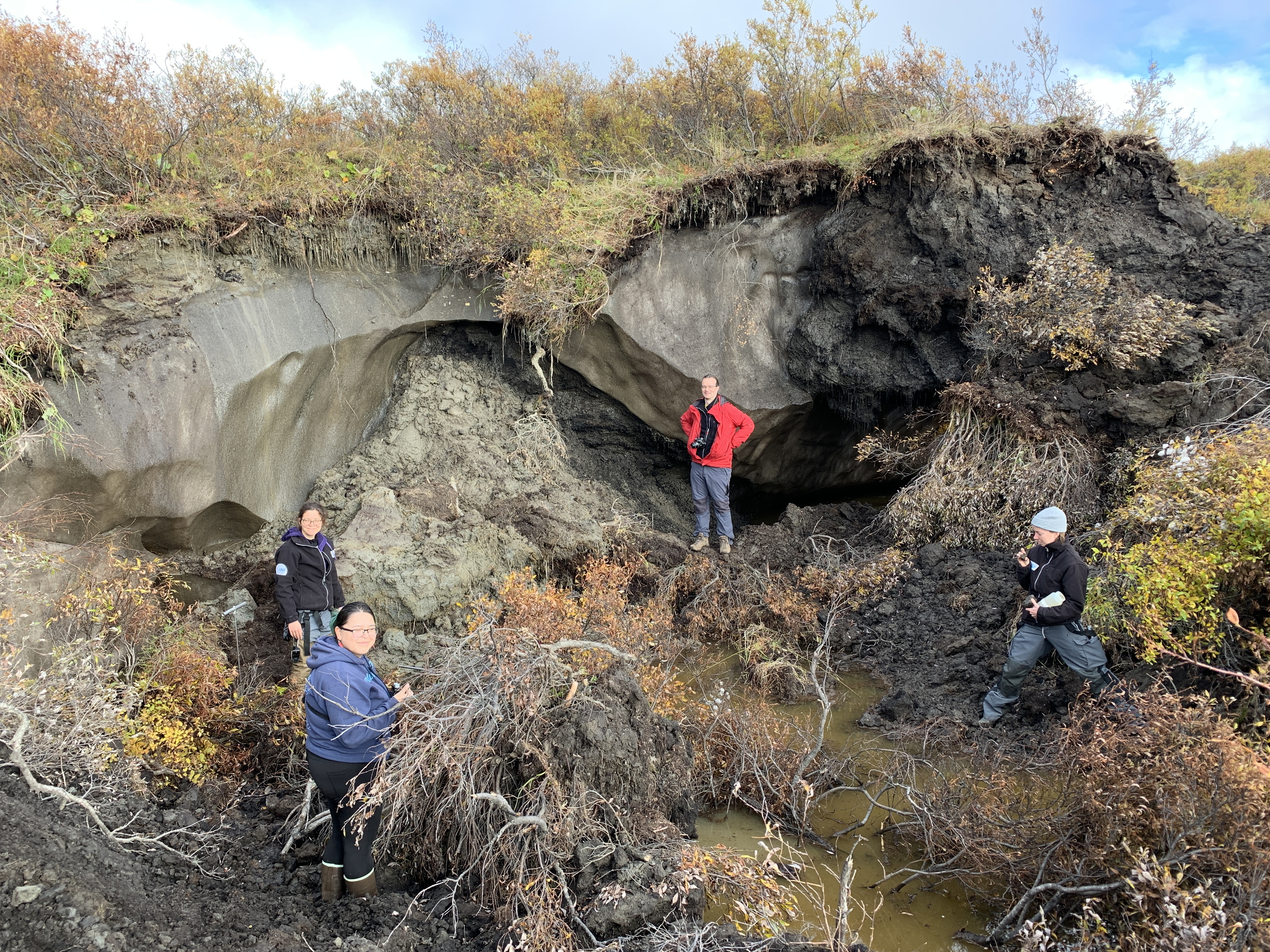
A fresh small thaw slump near Kotzebue. Photographer: Guido Grosse
Chunks of slush slide across the
bare ice and land on the muddy ground with a dull sound. After traversing a
dense willow thicket, a group of five scientists had the opportunity to observe
the effects of climate change in the Arctic firsthand. What is trickling away
here is permafrost, which is thousands of years old. Warmer temperatures are
contributing to its accelerated thaw.
The scene described took place in September 2023 on the eroding bluff of a thermokarst lake on the loop road near the village of Kotzebue (Baldwin Peninsula) in western Alaska. Recent thaw slumping had exposed large so-called Yedoma ice wedges. The international team, originating from Germany, Switzerland, Florida, and Alaska, came here to study permafrost and to document changes in the landscape.
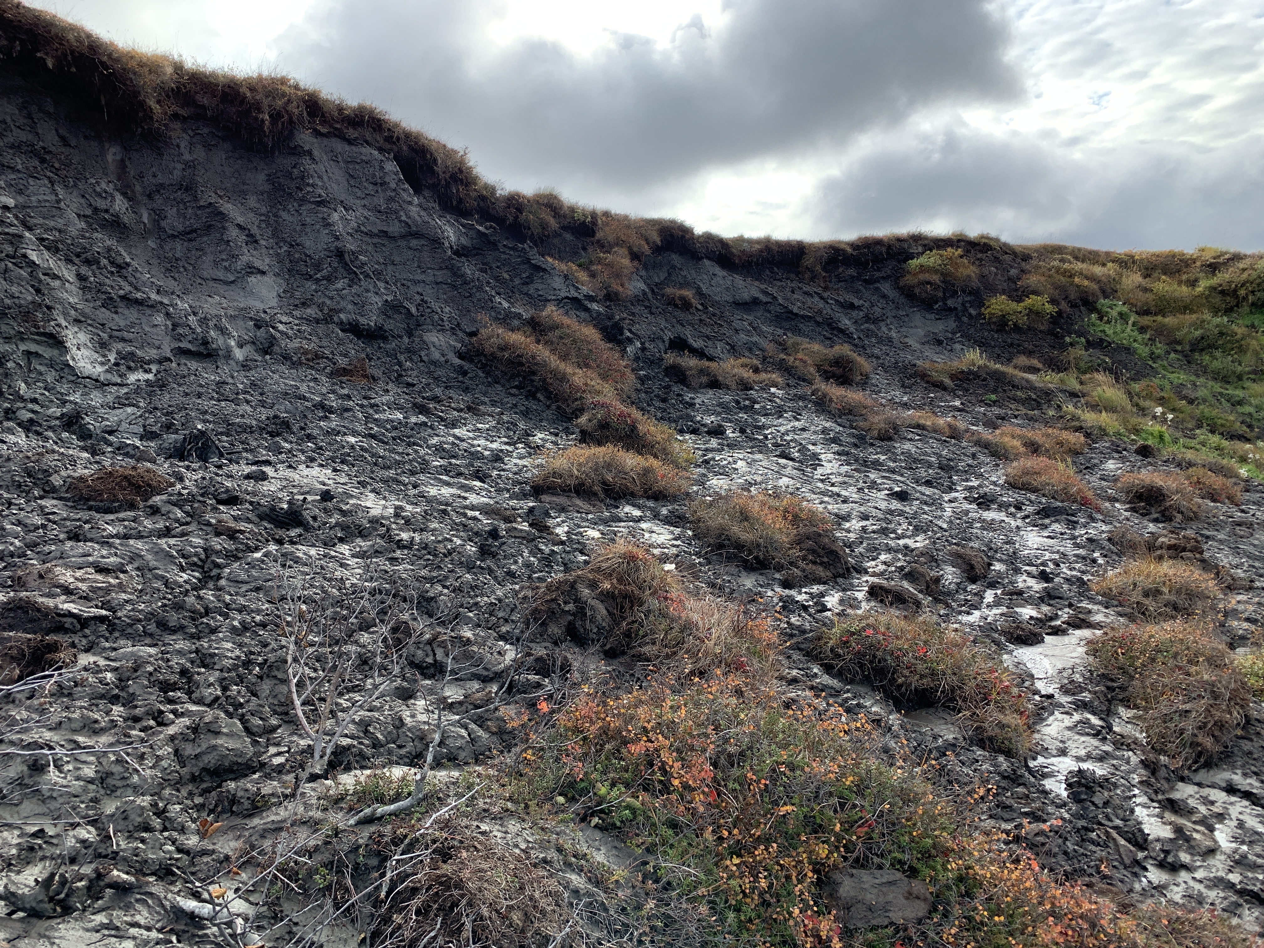
A large thaw slumpon the coast south of Kotzebue. Photographer: Guido Grosse
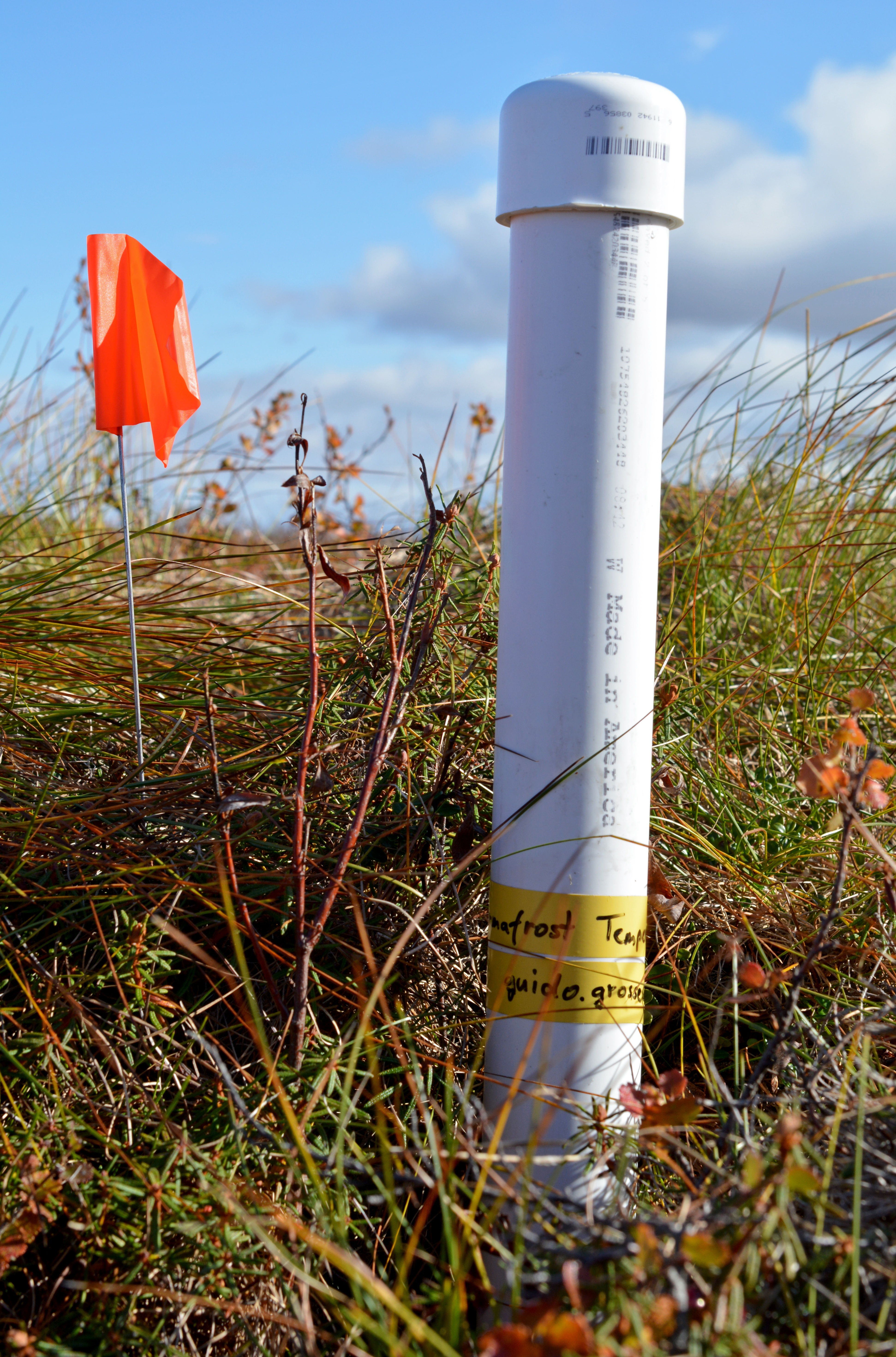
A temperature logger. Photographer: Tillmann Lübker
At four different field sites, ground
temperature measurements, topographic surveys, and drone surveys were conducted
to document the current state of permafrost landforms. The data will be compared
with observations made during previous field trips to determine thaw rates and
changes. In addition, lake water was collected for later analysis and samples
of permafrost cores were taken. The observations aim to better understand
temperature dynamics related to different degradation stages of thermo-erosion
gullies, drained thermokarst lake basins, and thaw slumps.
Greenhouse gas fluxes were measured using a special double bucket system equipped with a highly sensitive gas analyzer. This was done at sites with different vegetation and moisture conditions and in different stages of thaw to better understand biogeochemical processes that result from thawing permafrost. Permafrost can contain large amounts of frozen organic matter that, when thawing, is exposed to decomposition, releasing large amounts of carbon and nitrogen.
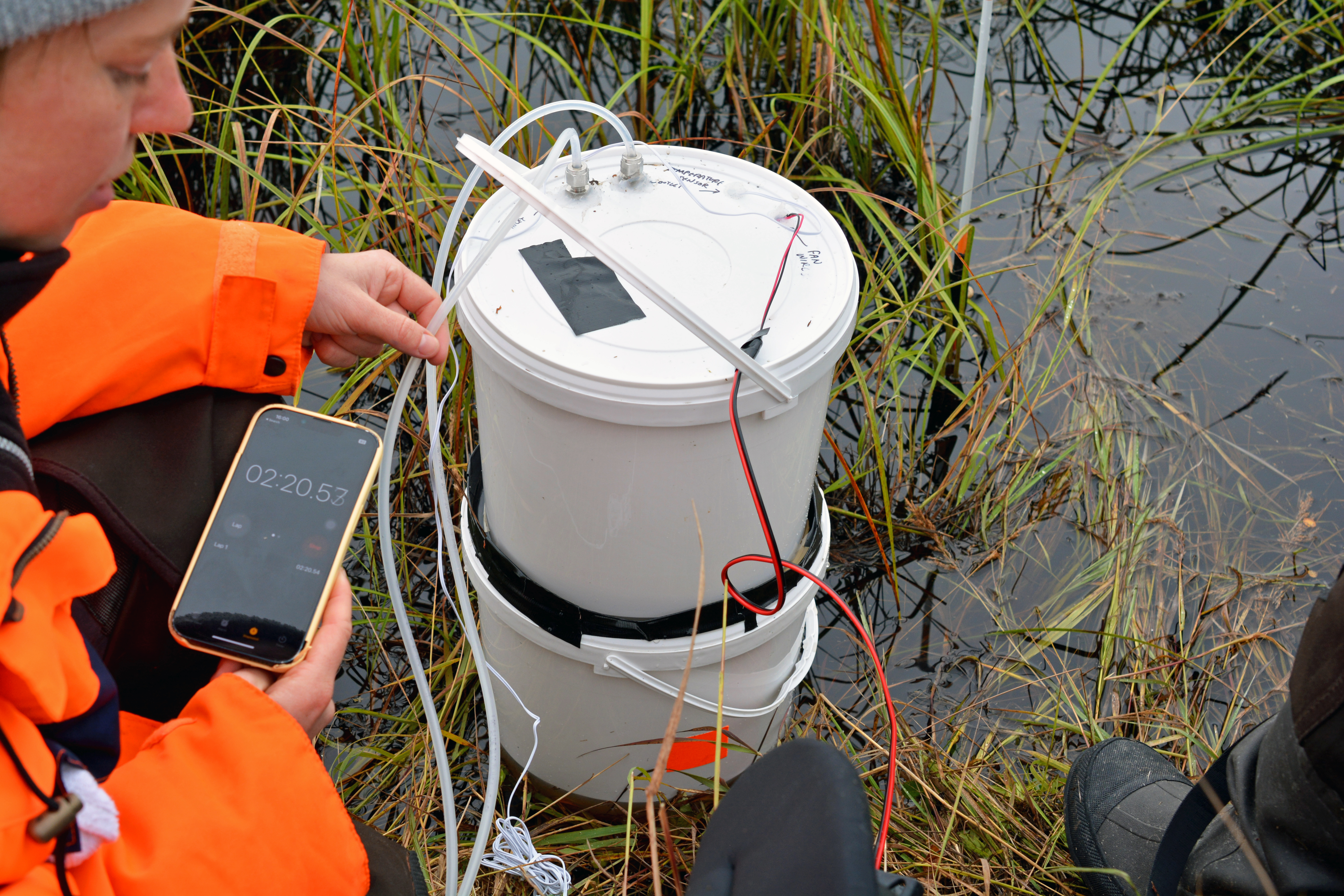
Greenhouse
gas flux measurements are measured with a double bucket system. Photographer: Tillmann
Lübker
The team from the Alfred Wegener
Institute (AWI) and the University of Alaska Fairbanks (UAF) brought not only
scientific equipment, but also a draft version of a new online tool. The ArcticLandscape EXplorer (ALEX) is currently being developed as part of Arctic
PASSION’s Pan-Arctic requirements-driven Permafrost
Service. This new portal will provide interactive maps of
recent information on land surface changes, hot spots of disturbance, and
potential areas of active permafrost thaw and erosion. By addressing
non-scientific audiences living on permafrost, it aims to make large and
complex pan-Arctic datasets on permafrost change visible at the local and
community level.
The ALEX tool was presented and discussed
at several meetings with local community members, tribal representatives, and
city and county officials. Receiving positive feedback and strong interest in
the tool, the researchers are encouraged to continue their work.
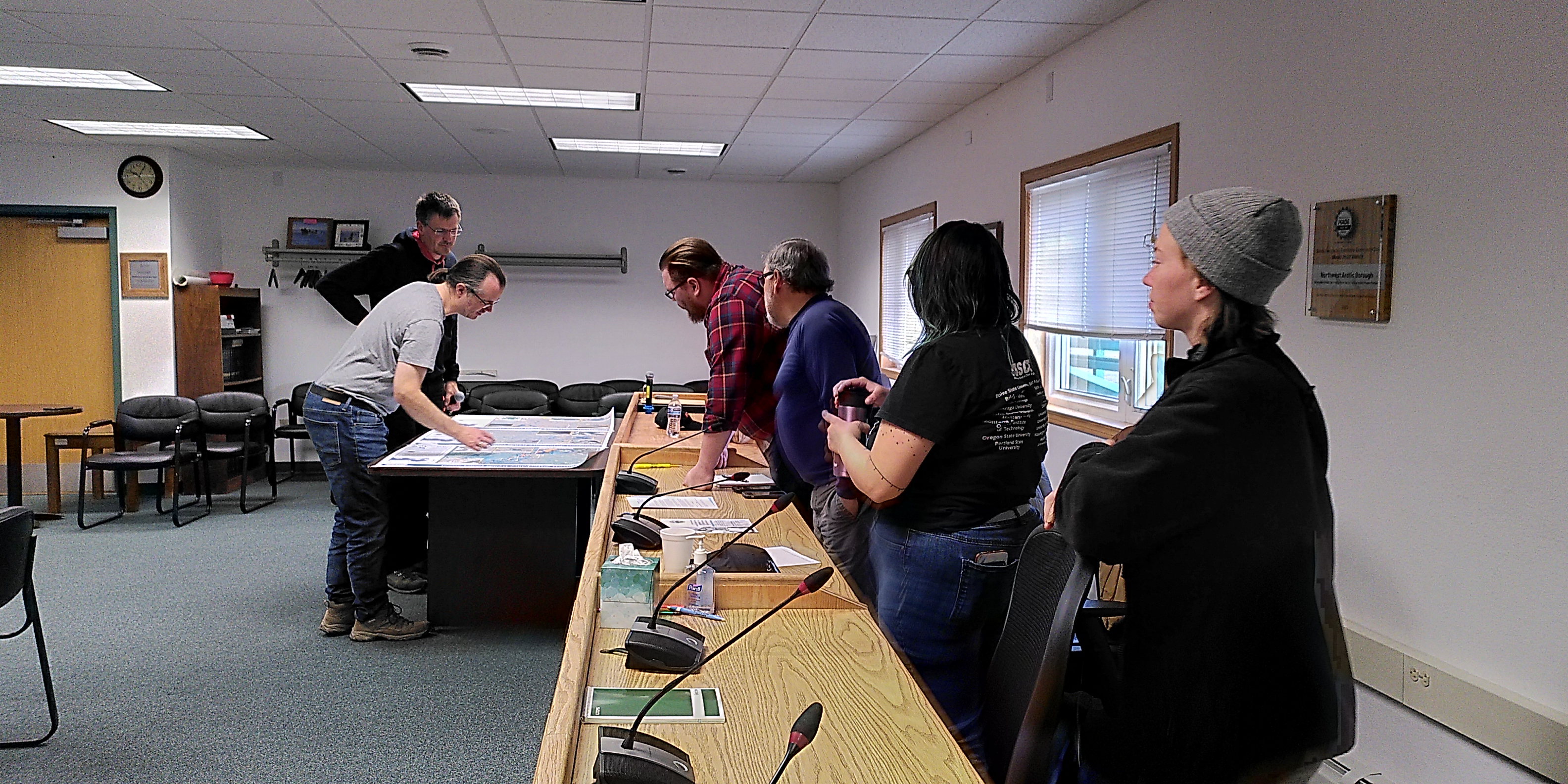
Presentation
of the ALEX tool. Photographer: Cornelia Inauen
In order to reach a study site
where a thermokarst lake had suddenly disappeared due to catastrophic drainage
in June 2022, the study team had to take all-terrain vehicles on a bumpy track.
The land owners living near the drained lake, Susan Schaefer Tessier and Tim
Tessier, surprised the group with a truly marvelous dinner at their home and
safely guided the group back to the main road.
Two other study sites on the
Baldwin Peninsula, an extensive large thermo-erosional gully system, and a
retrogressive thaw slump we reached by a jet boat piloted by captain Joe
Groves. During our last night in Kotzebue, we were once again able to experience
the warm hospitality of rural Alaska.
Before arriving in Kotzebue, the
team had already spent a week in Nome (Seward Peninsula). The main field site
here was a 2.5 hour drive by pickup truck – a very recent washed-out segment of
the gravel road was fixed just in time to safely reach the field site.
In the slightly hilly region, at
approx. 300 m elevation, a thermo-erosion gully was studied. Along two transects,
a temperature lance was pushed into the ground to measure soil temperature at
vertical intervals of 10 centimeters. A thinner metal rod, called an active
layer probe, was used to determine the depth of the layer of soil above the
actual permafrost that thaws during the summer – the active layer thickness.
Additional drone surveys, coring, lake water sampling, and greenhouse gas flux
measurements left little time to pick the abundant blue berries, which were just
ready to be eaten on the spot during the beautifully colored fall season of the
West Alaskan tundra.
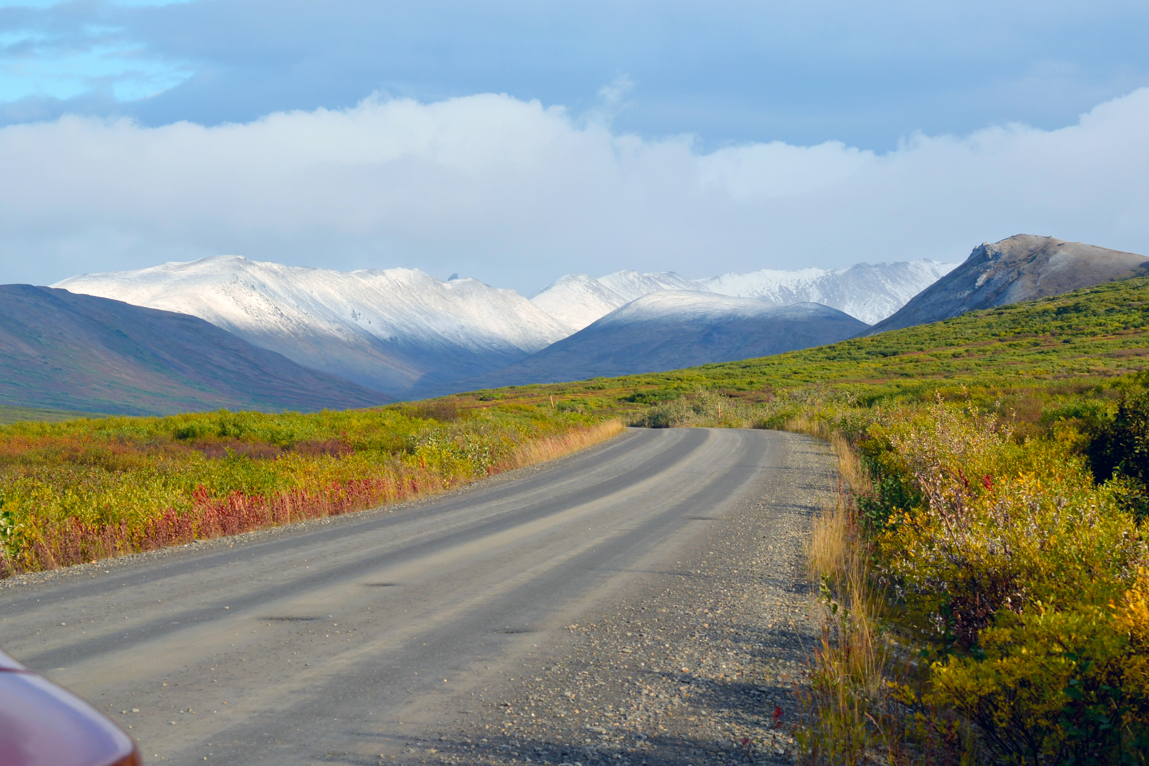
Road
leading to central Beringia. Photographer: Tillmann Lübker